Twin Cities Drone Photography: Real Estate Guide

Updated: Sep 9
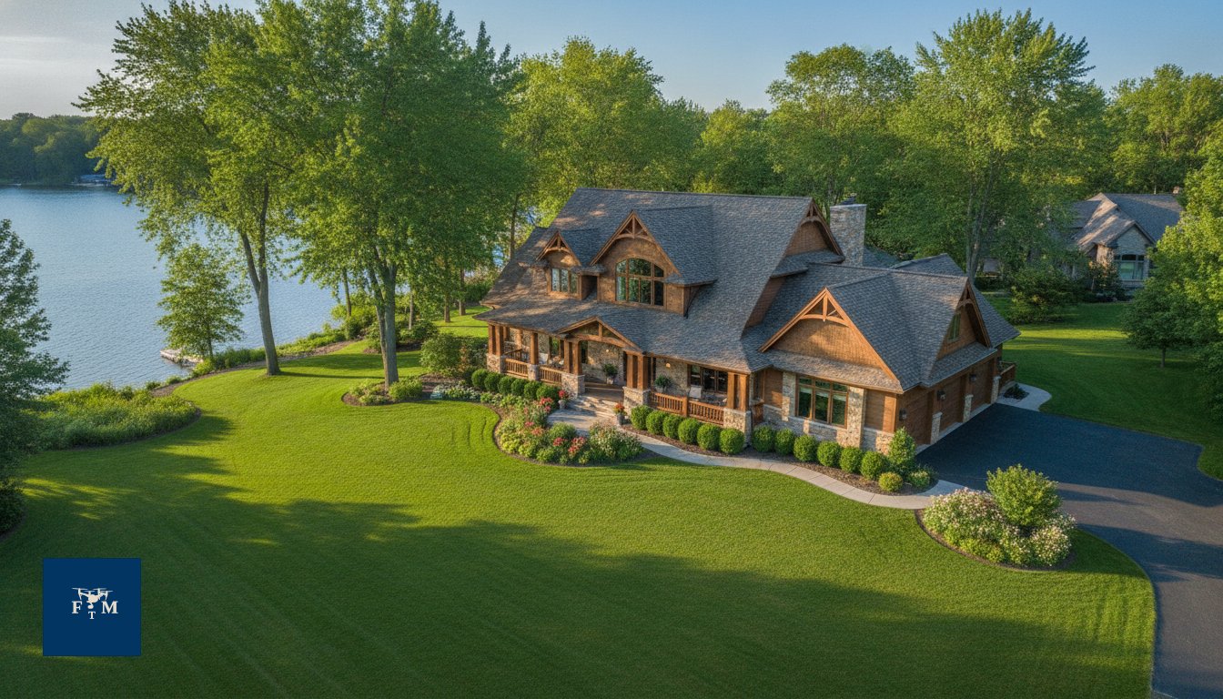
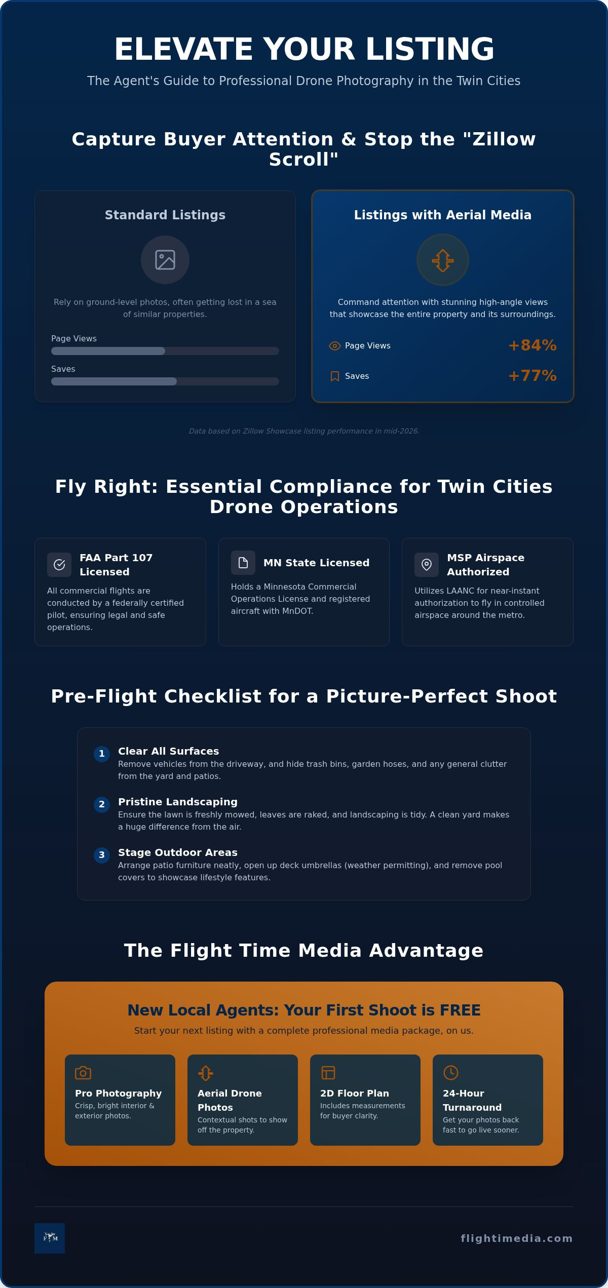
Did you know that active Zillow Showcase listings received 84% more page views and 77% more saves in mid-2026 compared to standard listings? It's clear that Twin Cities drone photography has moved from a luxury add-on to a necessity for any agent looking to dominate the local market. You likely already feel the pressure of listings getting lost in the digital noise while you worry about the complexities of urban flight laws and slow media delivery.
We understand that the logistics of aerial media can feel like a hurdle, but the results are worth the effort. This guide shows you how professional aerial imaging transforms your marketing from a flat gallery into a high-stakes narrative. We'll outline the essential legal steps for FAA Part 107 compliance and the strategic ways to maximize your listing's ROI. You'll discover how we handle MSP airspace authorizations, why flight always depends on weather and safety, and how to use 24-hour media turnarounds to keep your Edina or Woodbury listings on schedule.
Table of Contents
Why Drone Photography is a Non-Negotiable for Twin Cities Real Estate
Aerial imaging uses unmanned aerial vehicles (UAVs) to capture a property's scale, neighborhood context, and architectural details from angles impossible to reach from the ground. While the history of aerial photography dates back to balloons and kites, modern drone technology allows us to deliver precision marketing assets for a fraction of the cost of traditional methods. In a market where buyers make decisions in seconds, an eye-catching aerial thumbnail is your best tool to combat the "Zillow scroll." Data from mid-2026 shows that listings featuring premium media receive 84% more page views than standard listings. Using Twin Cities drone photography ensures your listing is the one that stops the thumb and earns the click.
Beyond the house itself, buyers are looking for a lifestyle. In a city like Minneapolis, showing a home's proximity to the Chain of Lakes or the Mississippi River isn't just a bonus; it's a primary selling point. For luxury markets in Edina and Minnetonka, aerial perspectives are now a standard expectation rather than a premium upgrade. Buyers expect to see how a home sits on the lot and how it relates to the surrounding environment before they ever commit to a tour.
Visualizing the Neighborhood Lifestyle
Aerial shots provide a bird's-eye view of the "walkability" that defines many St. Paul and Minneapolis neighborhoods. You can clearly show how close a property is to local coffee shops, parks, or schools. For suburban listings in Woodbury or Lakeville, drones are essential for showcasing massive lot sizes and property boundaries that a wide-angle lens at ground level simply can't capture. It's about providing a complete map of the property's value. You can highlight nearby amenities like shopping centers or community centers to help buyers envision their daily routine in the area.
The Psychology of the Aerial Perspective
High-angle shots naturally establish a sense of prestige and exclusivity. They allow a buyer to see the entire estate at once, which builds immediate trust, especially with out-of-state relocations. Drone media also helps solve "hidden" property questions by showing the condition of the roof, the layout of the backyard, and the distance from neighbors. By removing these obstacles early, you're qualifying leads before they book a showing. It makes the transaction feel transparent and straightforward. If you're interested in how these visuals integrate into a full marketing package, you can explore our professional media services to see the impact of high-end quality. Twin Cities drone photography doesn't just show a house; it sells a complete vision of the home.
FAA Part 107 and Local Compliance: What Twin Cities Agents Need to Know
Operating a drone for commercial purposes in the Minneapolis-St. Paul metro isn't as simple as launching from the sidewalk. Any pilot capturing imagery to help sell a home must strictly follow FAA Part 107 regulations. Using a "hobbyist" friend or an unlicensed assistant creates significant legal and financial risks for the listing agent. If an accident occurs or the FAA identifies illegal commercial flight, the fines can be staggering. Professional Twin Cities drone photography requires more than just a high-end camera; it requires a deep understanding of federal and state laws.
In addition to federal rules, Minnesota requires commercial operators to hold a state-level Commercial Operations License and register their aircraft with MnDOT for a $25 annual fee. The Twin Cities presents unique challenges due to the Class B airspace surrounding Minneapolis-St. Paul International Airport (MSP). This controlled airspace extends across much of the metro area, often requiring specific authorization for even low-altitude flights. We use the Low Altitude Authorization and Notification Capability (LAANC) system to secure near-instant approval for properties in these zones. However, it's vital to remember that flight operations always depend on airspace, FAA rules, weather, and safety. High wind speeds or sudden Minnesota precipitation can postpone a shoot, as we prioritize the safety of the property and the public.
Liability and Professionalism
Hiring an unlicensed operator doesn't just look unprofessional; it leaves you vulnerable. Professional pilots carry specific liability insurance for residential operations, protecting you and your clients from the unexpected. Flight Time Media uses only FAA Part 107 licensed operators for every Twin Cities shoot to ensure full compliance and peace of mind. If you want to see how we handle the technical details so you don't have to, you can learn more about our professional real estate media workflow.
Twin Cities Specific Flight Restrictions
Local rules add another layer of complexity. For instance, the Minneapolis Park & Recreation Board requires permits for operations over park property, and certain areas near government buildings in St. Paul are strictly regulated. We also respect the privacy of neighbors in dense Minneapolis neighborhoods, ensuring our flight paths are ethical and non-intrusive. While we strive to cover every listing, not every property can be flown due to these multi-layered restrictions. Twin Cities drone photography providers must be diligent in checking temporary flight restrictions (TFRs) that often pop up during major sporting events or dignitary visits. We handle the research and FAA channels for you, identifying what is possible before we even arrive on-site.
Comparing Aerial Formats: Stills, Video, and Immersive FPV
Not all Twin Cities drone photography is created equal. Choosing the right format depends on your property's unique selling points and the specific story you want to tell. While some listings thrive with a simple set of high-resolution stills, others require the immersive energy of motion to truly convey their value. According to NAR drone marketing statistics, listings with aerial imagery are significantly more likely to capture buyer interest, but the specific medium you choose dictates how long a prospect stays engaged with your page.
The Power of Aerial Stills
Stills are the workhorse of real estate marketing. Every listing gallery needs at least 5-10 essential aerial shots to establish geographic context. This includes the "hero shot" for the MLS cover, which should show the home's primary facade from a slightly elevated angle to emphasize curb appeal. Stills also provide practical transparency by clearly showing the roof condition and property layout for prospective buyers. High-resolution imagery is a core component of Zillow Showcase Media, helping buyers understand the physical boundaries of a suburban lot in Woodbury or the architectural scale of a custom build in Edina.
When to Choose Aerial Video
Video creates an emotional connection that stills can't match. It's particularly effective for social media platforms where agent reels can quickly build momentum by showcasing a home's lifestyle. Use video to demonstrate the "flow" of a property, such as moving from a lakeside patio to the front entrance in one smooth motion. Integrating drone footage into professional real estate videography allows you to tell a cohesive story of the home and its surroundings, making the listing feel like an experience rather than just a transaction.
For luxury estates or unique architectural projects, FPV (First Person View) drones offer a "one-shot" transition that moves seamlessly from indoor to outdoor spaces. This technology allows the camera to fly through a front door, navigate a grand foyer, and exit through a back balcony in one continuous sequence. It’s a high-impact tool for high-end condos in downtown Minneapolis or sprawling acreage in Lakeville. Matching the format to the property ensures you don't over-invest in Twin Cities drone photography that doesn't serve the listing's specific needs. Urban condos benefit from tight, low-altitude street-context shots, while rural properties need wide-angle vistas to capture the full scope of the land.
Preparing Your Listing for a Drone Shoot: A Professional Checklist
Success in Twin Cities drone photography starts long before the propellers spin. Aerial cameras capture a comprehensive view of the property, meaning ground-level clutter that might be hidden in standard photos becomes obvious from above. To ensure your listing looks its best, you must treat the entire exterior as a stage. A clean, organized environment allows the viewer to focus on the home's features rather than distracting debris.
Start by removing all vehicles from the driveway and the street directly in front of the home. This creates a clean, inviting look and prevents the property from appearing crowded. Hide trash bins, garden hoses, and children's toys in the garage. Ensure the lawn is freshly mowed and any seasonal debris, like fallen branches or piles of leaves, is cleared away. These small steps make a significant difference in the final quality of your media.
Communication is also a vital part of the process. Notify the immediate neighbors about the scheduled flight to prevent potential complaints and ensure a smooth, uninterrupted session. We use only FAA Part 107 licensed operators to handle these flights safely and legally, providing peace of mind for both you and your clients. Finally, consider the timing. We often recommend "Golden Hour", the hour just after sunrise or before sunset, as the gold standard for lighting. It provides a warm, soft glow that highlights the home's architectural features without the harsh shadows of midday.
The 24-Hour Prep Guide
Follow these three steps to ensure your property is ready for the lens:
Step 1: Clear the driveway and the immediate street of all vehicles. A vacant driveway makes the home feel more spacious and high-end.
Step 2: Close all windows and adjust the blinds so they're uniform across the entire house. Mismatched window treatments can look chaotic from an aerial perspective.
Step 3: Turn on all exterior lights. This is especially important for evening or twilight shoots, as it adds a welcoming, premium glow to the property.
Seasonal Considerations in Minnesota
Our local climate requires specific attention to detail. During the winter, meticulous snow removal is essential. Clear the sidewalks, driveway, and decks to provide a sharp contrast against the white landscape. For the most "lush" results, late spring and early summer offer the best neighborhood greenery. Because weather for Twin Cities drone photography can change rapidly, we monitor wind speeds and precipitation closely. If conditions aren't safe, we'll work with you to reschedule quickly to maintain your marketing timeline. Operations always depend on airspace, FAA rules, and safety first.
Ready to showcase your listing from a new perspective? You can book your professional real estate media session today and take advantage of our fast 24-hour turnaround.
The Flight Time Media Difference: Professional Drone Services with a 24-Hour Turnaround
Flight Time Media simplifies the complex logistics of property marketing by offering a unified media package. We've built our reputation on reliability and speed, serving real estate professionals across Minneapolis, St. Paul, and the broader metro area. By consolidating Twin Cities drone photography with ground-level stills and interactive media, we eliminate the need for multiple vendors and conflicting schedules. Our streamlined workflow ensures that from the moment you book to the final delivery, your experience is professional and frictionless.
Unbeatable Speed and Quality
In a competitive market, timing is everything. We offer a 24-hour photo turnaround promise to help you get your listing live faster. This velocity doesn't come at the expense of quality. Every image undergoes high-resolution editing to ensure perfect lighting and clarity, making every Minnesota sky look vibrant regardless of the weather on the day of the shoot. Our editors work to enhance the natural beauty of the property while maintaining an authentic look that builds trust with buyers.
For new agents, we offer the ultimate low-risk entry into professional marketing. Your first real estate photography shoot is FREE. This introductory offer includes professional drone photos and a 2D floor plan with measurements, providing you with a complete toolkit to impress your sellers. We believe in our process enough to let you experience the results firsthand without an initial investment. You can see how we integrate these assets with 3D tours and floor plans to create a comprehensive digital twin of your property.
Your Partner in Real Estate Growth
Consistent, high-end media does more than sell a single house; it builds your personal brand as a top-tier professional. When prospective sellers see your name attached to premium visuals and Twin Cities drone photography, it establishes immediate authority. Our booking platform is built specifically for busy professionals who value their time. You can schedule a shoot in minutes, knowing our team will handle the technical and logistical details, including FAA Part 107 compliance. It's important to remember that flight operations always depend on airspace, FAA rules, weather, and safety, so we handle the pre-flight research for you.
We position ourselves as the dependable backbone of your marketing efforts. Our goal is to make you look your best to your customers by providing predictable, high-quality results every time. Whether you're listing a modern condo in the North Loop or a historic estate in Summit Hill, we provide the visual edge you need to close the deal. Take the first step toward a more efficient marketing strategy. Book your free first shoot today and discover why local professionals trust us to elevate their listings.
Elevate Your Marketing Strategy Today
Transforming a standard listing into a high-impact digital experience requires a strategic approach to visual media. By integrating Twin Cities drone photography into your marketing plan, you provide the neighborhood context and architectural scale that modern buyers demand. Professional compliance and safety remain the foundation of every successful flight. Our FAA Part 107 licensed operators handle the complex airspace authorizations near MSP, allowing you to focus on closing the deal while we manage the technical hurdles.
Staying ahead of the competition means moving quickly. Our streamlined workflow and 24-hour photo turnaround ensure your properties go to market without delay. Whether you need comprehensive media packages featuring Zillow Showcase and 3D tours or high-resolution stills, we are your partner in real estate growth. Don't let your next listing get lost in the digital noise. Take the first step toward better results with a risk-free trial of our premium services.
We look forward to helping you showcase your next property with the precision and quality it deserves.
Frequently Asked Questions
Is drone photography legal for real estate in Minneapolis and St. Paul?
Yes, drone photography is legal for real estate in Minneapolis and St. Paul when conducted by an FAA Part 107 licensed operator. Federal law requires this specific certification for any commercial use, including marketing a property listing. Additionally, Minnesota law requires commercial operators to register their aircraft with MnDOT and maintain proper liability insurance. We ensure all our flights comply with these multi-layered regulations to protect you and your clients from legal risks.
How much does Twin Cities drone photography typically cost?
Pricing for professional media varies based on the scope of the project and the specific packages you choose. While we don't list flat rates here, we prioritize value by offering comprehensive media packages that can include 3D tours and floor plans. New clients can take advantage of our free first shoot offer to experience our quality without an initial investment. Contact us directly to discuss a tailored solution for your specific listing in Edina or Minnetonka.
What happens if my listing is in a restricted flight zone near MSP?
If your listing is within the Class B airspace near MSP International Airport, we use the LAANC system to request digital authorization from the FAA. While this often allows us to fly at specific altitudes, some areas are strictly prohibited for safety reasons. We research every property before the shoot to identify these limitations. Remember that flight operations always depend on airspace, FAA rules, and safety; we'll inform you immediately if a flight isn't possible.
Do I need to be present at the property during the drone shoot?
You aren't required to be present during the drone shoot, provided we have clear access to the exterior of the property. If your package includes interior media like Zillow 3D Home Tours, we'll need a way to enter the home, such as a lockbox code. Many agents in Woodbury and Lakeville find it more efficient to let us handle the shoot independently. We'll ensure the property is secured before we leave the site.
How long does it take to receive the drone photos and video?
We deliver your professionally edited photos within 24 hours of the shoot. This fast turnaround is a core part of our commitment to helping agents in the Twin Cities stay on schedule. Video content and interactive tours may require additional processing time depending on the complexity of the project. You'll receive a notification as soon as your high-resolution assets are ready for download from our secure booking platform, allowing you to go live quickly.
Can you fly drones in the winter or during bad weather in Minnesota?
We can fly during the Minnesota winter, but operations are strictly weather-dependent. Drones cannot fly safely in heavy precipitation, high winds, or extreme temperatures that exceed the aircraft's limits. For the best Twin Cities drone photography results, we look for clear days with good visibility. If the weather doesn't cooperate on your scheduled day, we'll work with you to reschedule as quickly as possible once conditions improve for safe flight.
What is included in the free first shoot offer for new clients?
The free first shoot offer is designed as a risk-free entry for new agents to test our professional real estate media services. This package includes high-quality photography, professional drone photos, and a 2D floor plan with accurate measurements. It's a comprehensive way to see how our 24-hour turnaround and high-resolution editing can elevate your brand. This offer applies to your first residential listing shoot in the Minneapolis or St. Paul metro area.
Do I need to notify the neighbors before a drone shoot?
While not always a legal requirement, we highly recommend notifying immediate neighbors before a drone shoot. This proactive step helps manage privacy concerns and prevents interruptions during the flight. It maintains your professional reputation in the community and ensures a smoother experience for everyone involved. We conduct all flights ethically and avoid hovering over neighboring properties. A simple heads-up often goes a long way in dense neighborhoods like those in St. Paul or Edina.


Comments